Network dataset
Upload the downloaded rental_agencies.csv.zip. Name the dataset rental_agencies. Here, the data is almost completely clean, and the main task is to geolocate the agencies; that is, for each row, retrieve the longitude and latitude corresponding to the address and zipcode.
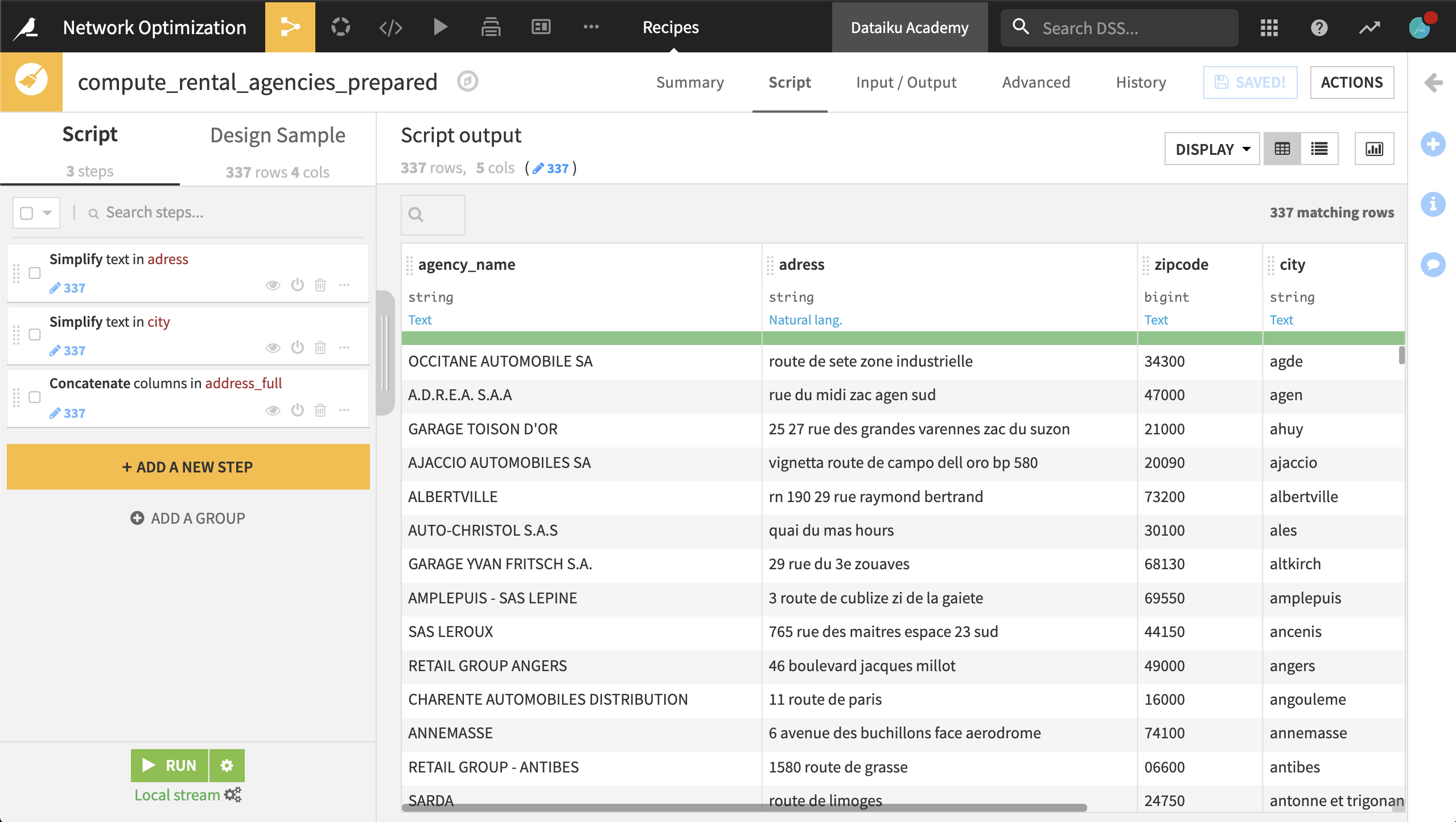
To do this, create a Prepare recipe with the default output name rental_agencies_prepared and the following steps:
Use the Simplify text processor on the adress column. This normalizes the text.
Use the same processor with city as the input column.
Using the Concatenate columns processor, concatenate the columns adress, zipcode, and city into the output column address_full, using a single space as a delimiter.
Run the recipe, updating the schema.
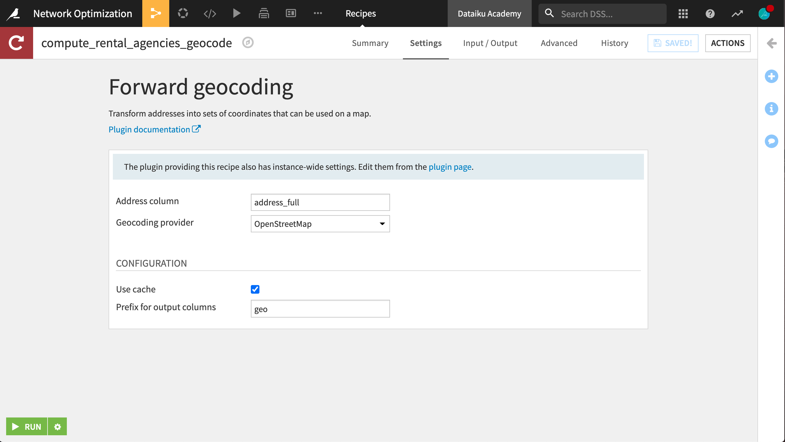
Now we want to use the Geocoder plugin to compute the latitude and longitude of each station’s address.
From the + Recipe dropdown in the Flow, select Geocoder > Forward geocoding.
Set rental_agencies_prepared as the input dataset and create
rental_agencies_geocodeas the output.Select address_full as the address column and select your choice of provider to retrieve the latitude and longitude of each rental agency. Specify
geoas the prefix for the generated columns.